Between the Years

Photo: Katrin Schönig

By Paul Scraton:

We were supposed to leave on Boxing Day, but the waves raced in off the North Atlantic, crashing against the harbour walls and rolling over the loading bay where the fishing boats had been pulled on wheels out of the ocean’s reach. There was no ferry that day, as there hadn’t been since the 17th December, and the forecast was not good.

For two further days the wind and the waves hammered at the island. São Jorge is a thin sliver, a line of volcanic peaks falling away towards the ocean. If there is flat land to be found it is often on lava debris fields at the foot of cliffs, where villages were built that, for centuries – and in some cases still – are only accessible by foot. Across the channel it is possible to spy the neighbouring islands of Pico and, from the right vantage point, Faial. But if the winds and the waves are high, it does not matter how close they might be. No boats will leave the harbour, and no planes will rise from the airstrip.

We hunkered down, waiting for the break. At a local surf shop, the owner looked at the same website as the owner of our guesthouse had shown us on his phone. A line of coloured boxes, filled with numbers. The website is hosted in the Czech Republic but is apparently bookmarked on every browser in São Jorge. The surf shop owner translated what it meant. High winds. Big waves. We weren’t going anywhere.

Each evening came and with it the message that the ferry was cancelled for the following morning, until one evening when it didn’t. Our guesthouse owner was hopeful. Tomorrow, you can sail. But he promised to leave our beds made just in case. We were to message him only once we left harbour. Only then, would he know we had finally checked out.

At the port in the morning a trickle of passengers became a tide. It was more than ten days by now since the ferry to Pico and Faial had run. In that time, Christmas had come and gone, although the decorations were still up in town and festive songs were still playing through the loudspeakers that had been erected some time in December. Passengers checked in their bags and waited in the terminal buildings. 

Others lined up their cars, waiting to board. At the check in counter, a woman delivered a parcel that would travel on the ferry without her. A man did the same. A taxi driver delivered three boxes and then queued to pay for the transportation, before driving off to work the next fare. The weather forecast for the next day was bad, and for the day after too. This might be the only chance.

Photo: Katrin Schönig

We sat on deck and watched Velas and São Jorge slowly retreat. It would take two and a half hours to reach Faial via Pico, and the island remained in view throughout. It was a long farewell. The first crossing was rocky, the second was rough. Perhaps they wouldn’t have made the crossing if it hadn’t been more than a week since the last one. We stayed on deck and watched the horizon. Some passengers slept, laid out across the plastic chairs. Others headed inside and tried to ignore the motion, watching films on their phones or tablets. 

In the channel between São Jorge and Pico, in the central islands of the Azores in the middle of the Atlantic, the internet connection was better than Berlin. We weren’t surprised.

We were between the years and between the islands. In the channel between Pico and Faial a windsurfer raised alongside the ferry, flying above the waves that we were crashing through. The waves seemed to grow bigger the closer we got to Horta and our destination. The spray reached the top deck. Gulls hovered above. At least one passenger was sick. The time between the years is usually when nothing much happens. As we approached land and the rise and fall of the ferry seemed to intensify, we wondered if there were any more surprises left. 

At Horta harbour, where sailors from around the world have left their mark in colourful murals on the harbour wall, and where the first transatlantic seaplanes used to land between the boats, we felt solid land beneath our feet. That evening in Faial, we would still be able to hear the ocean breaking against the rocks below where we were to sleep. We could still feel the motion where we lay. And we could see the dance of the white horses as they broke between the islands behind our closed eyes.

Outside it was calm. The sky had cleared and the stars shone down on the islands and the ocean. Tomorrow, the sun would shine. But the waves had been growing, and the colours and the numbers on the Czech website were not good. The messages had been received. The ferry for the next morning had already been cancelled. 

Photo: Katrin Schönig

***

Paul Scraton is the editor in chief of Elsewhere: A Journal of Place. His latest book is In the Pines, a novella of the forest with photography by Eymelt Sehmer, and published by Influx Press.

Skytrails

fullsizeoutput_9.jpeg

By Leonard Yip:

Kruger National Park, South Africa
June 2019

We spend the day in search of lionesses – all afternoon in the jeep, through the golden dust clouds of the Sabi Sands, out onto the low bareness of the bushveldt at the height of its winter. 

Jess, our ranger at the wheel of the jeep, tears off-road across brambles and dirt ditches, stopping every so often where bush gives way to sand. The Shangaan tracker with us, aptly named Advice, dismounts here: tracing the padded footfalls of the big cats in that pliant, wind-dusted earth, ghosting into the acacias and re-appearing again with a new set of directions in which to chase.

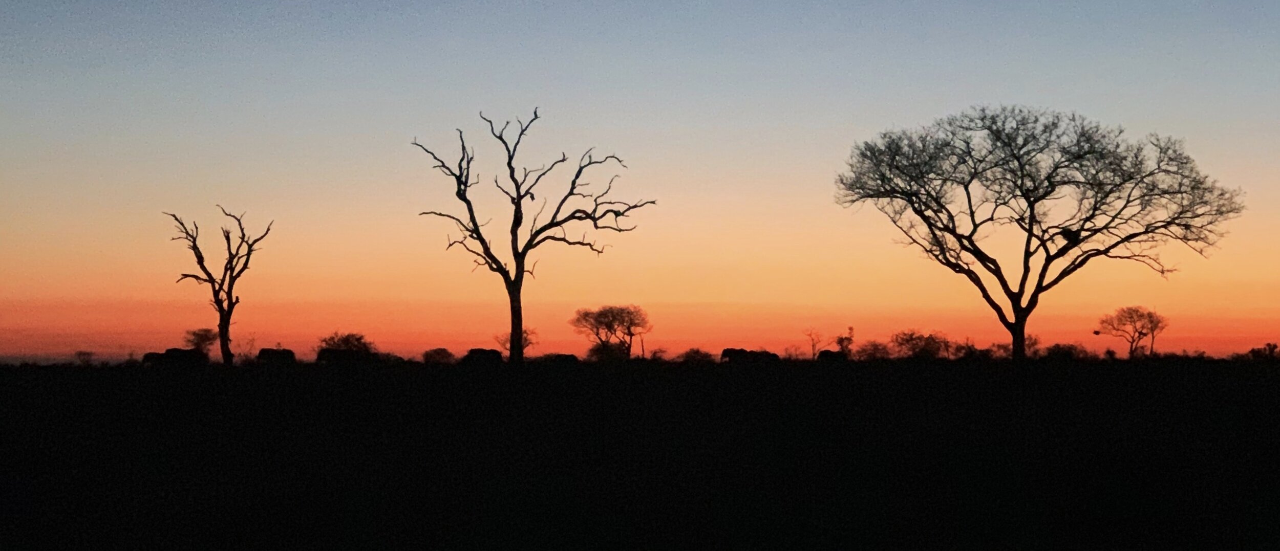
We never do see the lionesses that day, but the journey back to the lodge is marked with a quieter wonder. The sun sets and sinks and kisses the earth in fire, composing the leafless branches of fever trees into sharp silhouettes. Dark shapes of elephant herds in the distance move along the horizon line. In between the cold clarity of moonrise and the sun’s final dip beneath the Drakensberg mountains, there is a moment that seems to hang long and suspended in the clear air. Unprepared for the quickness of nightfall in the bush, I crane my neck upwards and the oncoming dark smothers me in its sudden descent: an entire sky dissolving to black.

Staring into its enormity, I lose my sense of perspective as it settles across the ends of the veldt. I sit in mute, fearful mesmerisation, this vast and unknowable thing erasing scale and obliterating our field of vision. Landmarks disappear and the roads before us are swallowed up into an inky chasm. My stomach lurches and I feel like I’m falling, leaping upwards into the infinity of everything I do not know. I reach reflexively for the guardrails of the jeep.

This uncanny, reversed vertigo clears only when the stars wink themselves into existence. The shapes of the veldt resolve themselves again faintly by the pinpricks of light. Cloud-like, the galaxy begins to pattern itself across the sky, looking for all the world like a rippling reflection of the road below us. Jess slows the jeep and leaves the lights dead. She and Advice teach us to navigate by the stars, locating the Southern Cross, mapping a southward bearing from where its lines bisect along the axis. They tell us the stories and folktales of the Shangaan bushmen – that the Milky Way is thought to be the trail walked by the spirits of their ancestors, and how a girl once threw the sparks from an ember’s core deep into the night sky, where they gathered into the constellations that guide the sojourner and the wayfarer home. 

Sat there listening, I am amazed at how acts of imagination become so closely tied to acts of pathfinding. I think of how writers and etymologists have followed the origins of the word ‘learn’ to the Old English ‘leornian’, meaning ‘to get knowledge’. The imprint of its lilting consonants and rolling vowels on our tongues trails even further back to the Proto-Germanic ‘liznojan’; to find a track. Learning, then, carries the same sense as following a track, making known the unknown through the tracing of one sand-swept footprint at a time. Even across cultures, how we make meaning of the world so often finds its way back to the very act of finding a way – galaxies becoming ground, stars turning to soil, walking and tracking as learning and understanding. Garnette Cardogan once wrote that ‘walking is, after all, interrupted falling.’ His words spring back to my mind as Jess and Advice map out the night sky for me, the resonance of trailblazing disrupting my sensation of upwards descent.

Advice turns on the searchlight, and the beam lances hot and bright ahead of us. The jeep trundles along the trail home. The air goes wild with the noise of the bush coming to life, and hyenas navigate by lone stars rising to their shadowed kills. Somewhere, lions roar into the night.

***

Leonard Yip is a Singaporean writer with an interest in landscape, people, place and faith - and often the intersections where these meet. He recently graduated with an MPhil in Modern and Contemporary Literature from the University of Cambridge, and his work can be found at leonardywy.wordpress.com

An Autumn Sunday afternoon walk around Rawhead

Rawhead_Julia.jpg

By Julia Bennett

Driving eastwards past the 150 year old mining engine house chimney - a lieu de mémoire for the dark dirty-secret past of this green and pleasant corner of England. This is the old Salt Road. Salt was carried from the Cheshire 'witches', the towns of Middlewich, Nantwich and Northwich, to the port at Chester, and later Liverpool, to trade with Africa and Asia. Up the steep Coppermine Lane to reach the top of the ridge. Squeezing in amongst a crowd of Sunday cars on the side of the road.

The path heads off. A stony farm road leading first west and then south towards Whitchurch. This is the Sandstone Trail tracing the sandstone ridge along the western side of Cheshire for 55 kilometres.

The potholed track soon dissolves into a footpath. Skirting the edge of the steep wooded hillside:

silver birch leaves burnished gold;

blood red rowan berries;

prickly sweet chestnut tempting hungry squirrels.

Trees frame distant views:

north across the Mersey, the solid square-built sandstone tower of Liverpool’s Anglican cathedral; closer, a cluster of slim flame-topped stacks pinpoint the oil refineries at Ellesmere Port. Closer still the Roman City of Chester hunkers down on the banks of the river Dee all but hidden in the folds of gentle rolling green pasture, that most English of English landscapes extending to the very edges of the country before drowning in the waters of the Dee.

… black rooks somersaulting against the blue-grey sky …

Across the fields to the east, beyond the giant white saucers of Jodrell Bank, the hazy beginnings of the Pennines.

… pinky-brown chaffinches flash white stripes as they flit from bush to bush …

The path narrowly clings to the edge of the soft, red sandstone cliffs. Cliffs formed during the Triassic period 250 million years ago, says the information board, once upon a time, a long, long time ago.

Not so very long ago, in the 1220s, Beeston Castle was built on a rocky outcrop, here in bas relief against the sky, a five kilometre walk north on the trail. Once upon another time it was the site of one of the Iron Age hillforts strung out along the ridge like a ‘join the dots’ guide to life here 3,000 years ago. . . . the trail following in ancient footsteps.

Steps lead down the side of the hill to a wooden platform. This is Dropping-stone well. Local people climbed up here to fetch drinking water as recently as the Second World War. In the not so distant past servants took sand from the caves which pockmark the soft sandstone to use on stable floors and as a scouring aid in the kitchens of the ‘big houses’. This was a busy, productive place, and not only on Sunday afternoons.

Rawhead itself, the trig point and the highest part of the Sandstone Trail stands at 227 metres. Rocks jutting above the trees, there are clear views from here. Over the border into Wales, Wrecsam’s industrial estate stands out against a background of the Clwydian Hills. Shropshire to the south and on a (very) clear day a faint outline of the Wrekin about 30 miles away.

The path turns southwards, continuing to snake along the very edge of the steep cliffs. Careful footsteps are needed to avoid sliding over the edge into the canopy of silver birch and scots pine that cloak the sides of the cliffs. Black holes mark caves in the rock faces.

A turn to the east. Rhododendrons flood a steep valley. A dull green for much of the year, in spring this ‘alien species’ large purple flowers are a prelude to the native purple heathers and plump ripening bilberries yet to come.

A small wood of scots pine, a cluster of farm buildings, the path runs next to a field separated by an electric fence. Noises off:

in the spring a cuckoo;

summer occasionally brings the insistent tapping of woodpeckers;

autumn, the rustling of pheasants in the maize stalks;

crows and farm dogs scrap and shout for attention all year round.

Down towards the kissing gate and the farm track. The Sandstone Trail turns towards the main road and southwards to Bickerton Hill. The sign to the Bickerton Poacher points left. This path follows behind the line of the fields and houses which border the main road. Overhung with stray fruit trees, damsons and crab apples tempt those walking beneath.

Crossing the muddy stream at the lowest point of the path, then uphill again past the memory of the industrial past: the brick chimney above Gallantry Bank.

Buzzards haunt the tall scots pines edging an open field, swooping ghostly shadows a prelude to their loud territorial claims. Shooting parties gather in this space. Gallantry is an elision of ‘gallows tree’. Hiding history in plain sight.

Over the stile and a steep climb up Coppermine Lane brings us back to the present.

Julia Bennett is a sociologist with an interest in place and belonging. She has lived in this part of Cheshire for 16 years.